Geo for All : the Open Source Geospatial Foundation for Educational outreach
02/05/2017

GEO FOR ALL is a joint initiative of the Open Source Geospatial Foundation (OSGeo), the International Cartographic Association (ICA), the International Society for Photogrammetry and Remote Sensing (ISPRS) and a follow-up of two joint Memorandum of Understanding (OSGeo-ICA; OSGeo-ISPRS). Everyone could get involved in @Geo4All_ and use free and open source geospatial technologies and educational materials to learn about GEO! GEO FOR ALL believes that knowledge is a public good and Open Principles in Education will provide great opportunities for everyone.
|
Countries have borders. Earth observations don’t ... By combing data over time, or by comparing data from different sources, intelligent decisions can be made about human development, wildlife protection and the effects of climate change. The huge monitoring capacity requires strong systems (GEO in Action). |
There has been tremendous growth in geospatial technology over the last few decades. Free and open geographic information (GI) software helps make geospatial education available to students from economically poor backgrounds worldwide (removing the need for high cost proprietary GI software).
GEO FOR ALL initiative is going to bring more opportunities for geospatial education worldwide, and especially to make it possible for students in developing and poor countries to be also able to get geospatial education. In this way, GEO FOR ALL contributes to building up Open Knowledge for the benefit of the whole society and for our future generations.
|
GEO FOR ALL aims at creating and maintaining shared open access educational resources and/or supporting active participation in the open source software and data development. Scroll down to: TRAINING Open Education is the simple and powerful idea that the world's knowledge is a public good and that technology in general and the Worldwide Web in particular provide an extraordinary opportunity for everyone to share, use, and reuse knowledge. Open educational resources (OERs) are free and openly licensed educational materials that can be used for teaching and learning. |
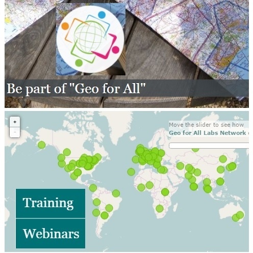
To date, almost 120 Open Source Geospatial Labs world-wide have already been established in universities around the world as part of Geo for All initiative:
|
# View the GEO FOR ALL Labs Network: all participants contribute to Education, Research and Service for the betterment of humanity as the key guiding principle and work towards the vision of the UN 2030 Agenda for Sustainable Development for building a better world. # See details of those labs' research and teaching areas. # See the wiki for the table of GEO FOR ALL Labs. |
Interested in joining the Geo for All Labs network?
# Feel free to join the global mailing list to follow the discussions among the participants of this initiative.
# Joining details are provided here and further information, including criteira for maintaining active status, can be found on the wiki.
___________________________________________________________________________________________________
Related content:
|
Geospatial data links information to a graphic reference; earth observation data is environmental data collected from remote sensing and satellite technologies. They are brought together using geographic information systems — computer systems that can capture, store, display and analyze data related to its location. To encourage new and innovative ways of delivering data management tools for cities, World Wind Project Manager Patrick Hogan established the NASA World Wind Europa Challenge in collaboration with Politecnico di Milano, Geo for All, Global Open Data for Agriculture and Nutrition (GODAN), Hub Innovazione Trentino and the Hungarian Association for Geo-information. |
- International Conference for Free and Open Source Software for Geospatial. August 14-19, 2017, Boston, MA
- Open Educational Resources: Some Basics (video)
- Copyright and Open Educational Resources (video)
-
Open Educational Resources (OER): Frequently Asked Questions
- Global Earth Observation System of Systems (GEOSS) : discover and access the data required to draw conclusions and make predictions
- The Open Source Geospatial Foundation celebrated its 11th Anniversary on February 4, 2017