OpenForis : Free Open-Source Solutions for Environmental Monitoring
01/12/2016

.jpg)
An FAO-led initiative OpenForis is a set of free and open-source software tools that facilitates flexible and efficient data producing, collection, analysis, reporting and dissemination in order to implement multi-purpose forest inventories and support environmental monitoring.
_____________________________________________________________________________________________________________
Forum on forests has been a priority on the international policy and political agendas for more than 20 years. Intense negotiations among Governments resulted in the Non-legally Binding Authoritative Statement of Principles for a Global Consensus on the Management, Conservation and Sustainable Development of all Types of Forests, also known as the “Forest Principles”, as well as Chapter 11 of United Nations Environment Program: Combating Deforestation.
“Forests make big targets - for better or worse. Planting trees, or cutting down forests, has major consequences. If we manage forests well they will give us goods and services that we cannot live without. If forests disappear we lose any prospect of sustainable development. Forests and trees are rooted in life and livelihoods. They can be grown, improved, and looked after - they are renewable” (Forests in the Sustainable Development Goals).
Forest resources can be expressed by data. To address the growing need for accurate and timely data and information on the state of forest resources and their use and users, FAO-Finland Forestry Programme in collaboration with FAO’s support to National Forest Monitoring and Assessment (NFMA) and the UN-REDD Programme launched (in 2013) the OpenForis initiative. OpenForis Tools were released in 2014 at the 24th World Congress of the International Union of Forest Research Organizations (IUFRO).
Echoing FAO’s broad experience in forest monitoring, OpenForis addresses cross-cutting issues through a set of highly flexible, easy-to-use software tools. These latter are designed, tested, applied and improved through FAO’s global network of partners and experts, who ensure that these tools are relevant and provide real value to beneficiaries.
OpenForis software tools - including documentation and source-code – can be used for free to manage and distribute reliable information on the state of forest resources. In particular, OpenForis tools support the entire lifecycle inventory, from needs assessment, design, planning, field data collection and management, estimation analysis, up to data dissemination. OpenForis tools include remote sensing image processing tools, as well as tools for international reporting such as for REDD+ MRV and FAO Global Forest Resources Assessment (FRA).
|
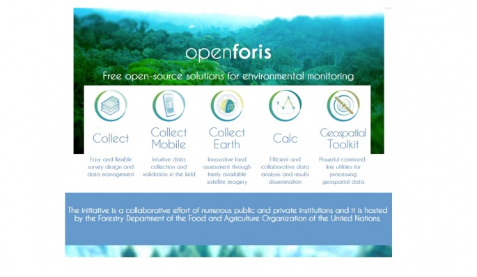
TOOL 1 : COLLECT (free tutorials) - is the main entry point for data collected in field-based inventories. It provides a fast, easy, flexible way to set up a survey with a user-friendly interface. With COLLECT you can handle multiple data types and complex validation rules, and all this in multilingual environment. |
|
TOOL 2 : COLLECT Mobile (free tutorials) - is a fast, intuitive and flexible data collection tool for field-based surveys. This Android app allows the completion of complex data structures, such as biophysical, socio-economic or biodiversity surveys. |
|
TOOL 3 : COLLECT Earth (free tutorials) - is a tool that enables data collection through Google Earth. In conjunction with Google Earth, Bing Maps and Google Earth Engine, users can analyze high and very high resolution satellite imagery for a wide variety of purposes |
|
TOOL 4 : CALC (free tutorials) - is a robust tool for data analysis and results calculation. The input data and metadata come from Open Foris COLLECT and CALC provides a flexible way to produce aggregated results which can be analyzed and visualized through the open source software Saiku. CALC allows expert users to write custom R modules to perform calculations working with a variety of sampling designs. |
|
TOOL 5 : GEOSPATIAL TOOLKIT (free tutorials) - is a collection of command-line utilities for processing geographical data. It aims to simplify the complex process of transforming raw satellite imagery for automatic image processing to produce valuable information. It is particularly useful for processing big amounts of raster data, and provides a wide range of functionalities including image manipulation, statistics, segmentation and classification. |
OpenForis tools and standards may be mixed and matched to best fit user needs. It is worth noting that open standards are guaranteeing maximum interoperability with existing local, national and international systems and infrastructure. Moreover, application of widely shared open standards facilitates data portability and guarantees data accessibility independent of future technology developments.
Government, research institutions and NGOs use OpenForis tools for a wide range of monitoring purposes such as:
- Forest Inventories
- Climate Change reporting
- Socio-economic surveys
- Biodiversity assessment
- Land Use, Land Use Change and Forestry measurement
- Deforestation monitoring with remote sensing
- Detecting desertification and trees outside of forest
The free sharing of all OpenForis software tools and standards promotes transparency, self-sufficiency and vendor independence, thus also providing a fertile ground for designing sustainable capacity development interventions. Moreover, being open-source means to be open to review by peers, promoting higher quality tools and encouraging and facilitating partner contributions.
Source: OpenForis open source tools
***
Last but not least...
Forest tenure, gender and land rights, and indigenous and community land rights are all key thematic areas related to land governance. For this reason, the Land Portal is launching the first three comprehensive thematic portfolios focused on these issues. These portfolios combine detailed narratives with Linked Open Data to provide comprehensive global overview (Land Portal, November 2016).
Might also be of your interest:
AgroForestry offers climate and sustainability benefits (FAO)
Capacity Building for REDD+ NFMS (FAO)
Global Forest Survey (GFS) project (FAO)
USDA Forest Service Geodata Clearinghouse : an online collection of digital data related to forest resources
