Open Geospatial Data Portal: Knowledge for Investment

The GeoPlatform embodies the principles and spirit of Open Government, accountability, and transparency. The GeoPlatform supports open formats, data standards, and common core and extensible metadata. The portfolio of data, applications, and services is stewarded through the use of open licenses and hosted on an infrastructure that maximizes interoperability.
___________________________________________________________________________________________________
“A key goal of the Geospatial Platform is to expand the use and understanding of national geospatial resources. Active social interaction plays an important role in sharing vital, timely knowledge to keep our collective data, content and services fresh and engaging” (GeoPlatform.gov).
“GeoPlatform provides open access to national datasets, allows users to add, upload and share their own data, and create maps and galleries that can be viewed and utilized by others” (GeoPlatform.gov - social).
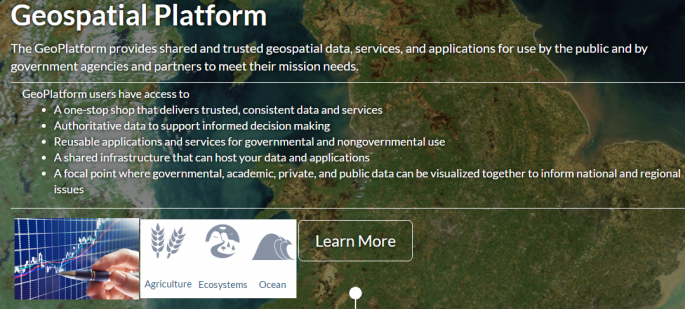
GeoPlatform.gov
- launched in 2011 by member agencies of the Federal Geographic Data Committee (FGDC) – is the open web data portal making geospatial data more sharable, accessible and usable with high-performance web services and better tools for managing the data.
GeoPlatform.gov pulls geospatial datasets from Data.gov (the home of the U.S. Government’s open data):

links machine-readable metadata to other online semantic registries, and provides users with open mapping tools that let users discover data,use the data to create and manage interactive web maps and applications which can be shared online, saved and embed onto users own webpages.
For registered users, GeoPlatform.gov also provides a Performance Dashboard that monitors the quality and availability of the site’s data and services:

.png)
Additionally, the GeoPlatform.gov team is developing tools allowing the site to suggest relevant data/map layers to users, as well as to improve GeoPlatform Marketplace - a social space where users can discuss the data they’re collecting, store projects, and view a list of all the planned data acquisitions.
The A-16 NGDA Theme Community is a shared workspace for communities with similar interests designed to access information related to 16 Themes, the Theme implementation process, training, and GeoPlatform-related activities:
Governmental Units, and Administrative and Statistical Boundaries |
Click on a community to view the a community's webpage and join the conversation. Community users can share seminal web content; publish geospatial data and services; build and share maps, applications, and tools; discover relevant geospatial data, tools, and services for community use; and share best practices, tips, and lessons-learned from their efforts.
GeoPlatform.gov platform serves as shared Cloud Host for data and applications
where users can easily share (after registration and log in), access geospatial data and find the most recently added resources on a wide range of Community topics
(NOTE: non-federal participants - e.g., universities, organizations, and tribal, state, and local governments - maintain their own data policies. It is important that users understand the data policies of participating entities in order to best utilize these datasets):
GEOSPATIAL DATA SEARCH : Search the geospatial catalog for relevent data to be used in your applications, maps and tools.
GEOPLATFORM CLIMATE RESOURCES : Find data and tools related to climate change. This resource area is focused on providing easy access to data and resources related to coastal flooding, sea level rise, and their impacts.
The GeoPlatform team continues to support the availability of open standards compliant catalog web services supporting Geoplatform.gov and Data.gov:
Publishing your data or service on the data catalog
can be completed in a few simple steps. But, prior to registering your data or service, there are a few preliminary pre-registration actions that should be performed before initiating the publication process.
- Ensure that metadata for data and services are complete, accurate, and compliant with metadata standards prior to registering. Please consult the Metadata Best Practices (PDF) resource to ensure that your metadata meets the publication criteria for the catalog.
- Once your metadata is ready for publication, create a publisher account with Data.gov. Once the account is approved, use How to Register Data (PDF) resource as your guide through the publication process.
Learn how to utilize the GeoPlatform to support your geospatial data needs (tutorials and trainings on topics like: producing compliant metadata, registering data, Community administration, and more)
If you need help or want to report an issue, please send an email at:
___________________________________________________________________________________________________
Sources:
- GeoPlatform.gov
- Geospatial Platform Update (slides, 2016)
___________________________________________________________________________________________________
In 2016, FAO hosted the launch of the FAO-IFAD Knowledge for Investment series, showcasing the latest geographic information system (GIS) tools that enable users to assess the situation ‘from the sky’, as well as provide a self-evaluation app on climate resilience that allows for ‘ground checking’ with rural communities. Applying these tools to agriculture initiatives can help improve project implementation and ensure more concrete impact assessments on a larger scale.
Google Earth Engine, Google Earth and Collect Earth are other user-friendly applications that allow land surface monitoring over time. In addition to monitoring physical progress during project implementation, the imagery produced by these tools can better accompany quantitative impact assessments on agricultural, pastoral and forestry operations on the ground.