Empowering Women for Open Data Mapping in Agriculture: Implications for Land Rights and the SDGs in Africa

This blog recapitulates the interventions made by the panelists of a recently held GODAN Action webinar on “Empowering Women for Open Data Mapping in Agriculture: Implications for Land Rights and the SDGs in Africa(link is external)”, Victor Sunday, Dr. Toyin Ojo, Nathalie Sidibe and Uchechi Shirley Anaduaka.
1) How do women perceive their land rights in Africa?
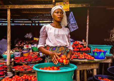
Women play important roles in agriculture, undertaking a wide range of activities relating to food production, processing and marketing.Women make up a significant part of the agricultural labor force in SSA (54.7%) but lower in Nigeria (26.1%). The low figures have been linked to the significant disadvantage women face with regard to their land rights.For example, < 20% of women own land in Nigeria (FAO, 2018).
In general in Africa, gender discrimination in land ownership, rights and access prevents women and their communities from realizing their full potential and contributing to sustainable development. Secure land rights for women is recognized as critical for achieving the Sustainable Development Goals (SDGs), particularly for eradicating poverty and ending hunger and gender equality (Goals 1, 2 and 5). Despite this, as per below, the majority of women view women’s land ownership as beneficial to various aspects of their lives, including their individual and collective psychological, social and economic well-being.

2) What are the values and benefits of open data sharing?
When we are talking about open data, we are talking about data that is available to everyone and data that is accessible. When such data is geographically referenced to any location, there will be a value added. This data could provide benefits such as findability, connectivity, interoperability, accessibility and availability. In terms of value and benefits to farmers, especially farmers in Africa, open data mapping can enhance agricultural digitization. It will can also enhance smart technology, findability, connectivity and availability.
3) What do we mean by Open Data Mapping? What are the implications for women’s land rights and their involvement in agriculture?
Open Data Mapping refers to the acquisition, processing, management, publication and geo-visualization of geo-referenced data. More specifically, Open Data Mapping provides geospatial databases, maps and geoinformation that are freely accessible and available globally. It provides the opportunity for everyone to freely share, use and reuse data about land use, farm lands, land rights and essentially, anything that is mapped on the Earth’s surface. With Open Data Mapping, we are able to know what is where and how, when as well as who owns what. Empowering women to drive open data mapping in agriculture is a sure trigger of multiple and measurable targets of SDGs in developing African countries. Data about where and who is empowered is critical, as well as knowing who owns a parcel of land for agriculture and where it is located. As a result of this, issues about women’s land rights, agricultural sustainability and the SDGs can be tackled with open data mapping. The Unique Mappers Network Nigeria, leverages open data mapping to drive GODAN Action, SDGs targets and women’s inclusive community engagement.It contributes to bridging the gap in gender digital divide by providing women the opportunity through capacity building and raising awareness to know about their Land Rights and benefits.
This approach positively impacts knowledge about women’s land rights and agricultural sustainability. We should advocate for open data infrastructure, in Nigeria and for all developing countries in Africa in general.
4) How does Open Data Mapping improve agriculture and land rights in general ?
One of the primary benefits of Open Data Mapping is that we can map land use. When it comes to agriculture, one of the prevalent questions is around location; where are we currently farming and rearing livestock? We want to know where, because there are certain lands in Africa where the soil is indeed of good quality for us to farm. Some of them are not actually good for farming and planting of crops, but we can actually use this land to rear livestock. One of the big concerns in Africa and Nigeria currently, is with regards to those rearing cattle. Due to the climate they then tend to move around between South and North, which has caused a lot of conflict. If we can map land and understand that a certain place has the right conditions for rearing this particular livestock, then we are able to build sustainable projects in those areas so that moving and migration around the country does not have to happen. We also want to know, for example, what types of crops are grown. Some of this information, we simply do not know because we don’t have access to the information. If we can map it, we can know that this place is actually for grey mushrooms, for example. When it comes to land rights more specifically, Open Data Mapping provides data acquisition, processing, management, publication and geo-visualization of land rights. Furthermore, it provides data for sharing about land documentation. Finally, it empowers women with land ownership rights.
5) Can you tell us more about the Ogrute Ugwu Eru Mapathon for SDG2 Food Security Project?
Ogrute is a community in the Enugu-Ezikein Enugu State, Nigeria. More specifically, the Ogrute community is the epicenter of a hill called Ugwu Eru. The Ugwu Eru Hill seasonally produces thirteen types of edible mushrooms. Mushrooms are known globally to be highly nutritious and to have health benefits, containing dozens of vitamins and minerals. Open data mapping in the Ogrute community provided critical geospatial data or SDG-2. Survey for the assessment of the food chain value was administered to more than 100 sampled participants in Ogrute. Reports indicate that mushroom grows mostly during the rainy season. Data about the benefits mushroom, productivity, frequency of consumption and type of farming carried out was assessed. Regarding data about housing and land ownership, the type of buildings, purpose of the buildings, as well as the year of building were also assessed. More than 5000 buildings were added to OpenStreetMap for the Ogrute Community.
6) Finally, can you tell us more about Open Data Mapping in the context of the Covid-19 pandemic?
Kpaduma village is a community consisting mainly of poor farmers in Nigeria. The impact of the COVID-19 pandemic required intervention for the community. Mobile data collection was carried out following food distribution and intervention. Data collection supported in knowing
The Impact of the pandemic Covid-19 necessitated intervention for the community. Mobile data collection was carried out following food intervention and distribution. Data collected helped in knowing where and how palliative measures were dispersed.
More information can be found here: http://umap.openstreetmap.fr/en/map/richfloodfoundation-covid19_445355#15/9.0167/7.5188(link is external)

